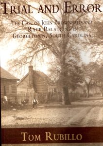
Pictured are a group of men from the Washington Light Infantry on the steps of the Winyah Inn, which was located on the corner of Prince and Screven streets in Georgetown. The men were in town to help keep the peace after race riots broke out in Georgetown in 1900 during the John Brownfield saga, which is the subject of Rubillo’s fascinating book. Picture courtesy of Georgetown County Museum via the Georgetown County Digital Collection.
Excerpt, page 16:
“Until the early twentieth century, sailing ships were the principal means by which people entered or left the county. The extreme density of the underbush in its semi tropical forests and generally swampy nature of much of its abundant lowlands have made it almost impossible to enter or leave Georgetown County without traveling by water at some point. Even the few narrow dirt roads that led out of the county were interrupted by rivers that had to be crossed by ferry. The only other way out was by booking passage on a ship sailing to sea. These physical features made a land escape from Georgetown almost impossible, both for slaves and, after abolition, anyone seeking to leave on foot, by horse or, later, by horseless carriage without being seen or easily tracked. This physical isolation also limited the flow of information from the outside world to that which the editor of the local newspaper decided to publish and that which filtered in through the mail.
The first land connection with the outside world was made in 1924 when a bridge was constructed over the Black River about 10 miles to the west of town. The bridge replaced the ferry service there. The next connecting bridge was about 25 miles to the north of town. It was built over the Pee Dee River delta at the county line at a place called Yauhannah. The next bridges opened in 1928 spanning the North Santee and South Santee Rivers about a dozen miles south of town and connecting Georgetown with Charleston County. (U.S. 17 South to Charleston)
These structures completely changed Georgetown, transforming it from a remote backwater of South Carolina to a place that is open to the outside world and its influences.”